
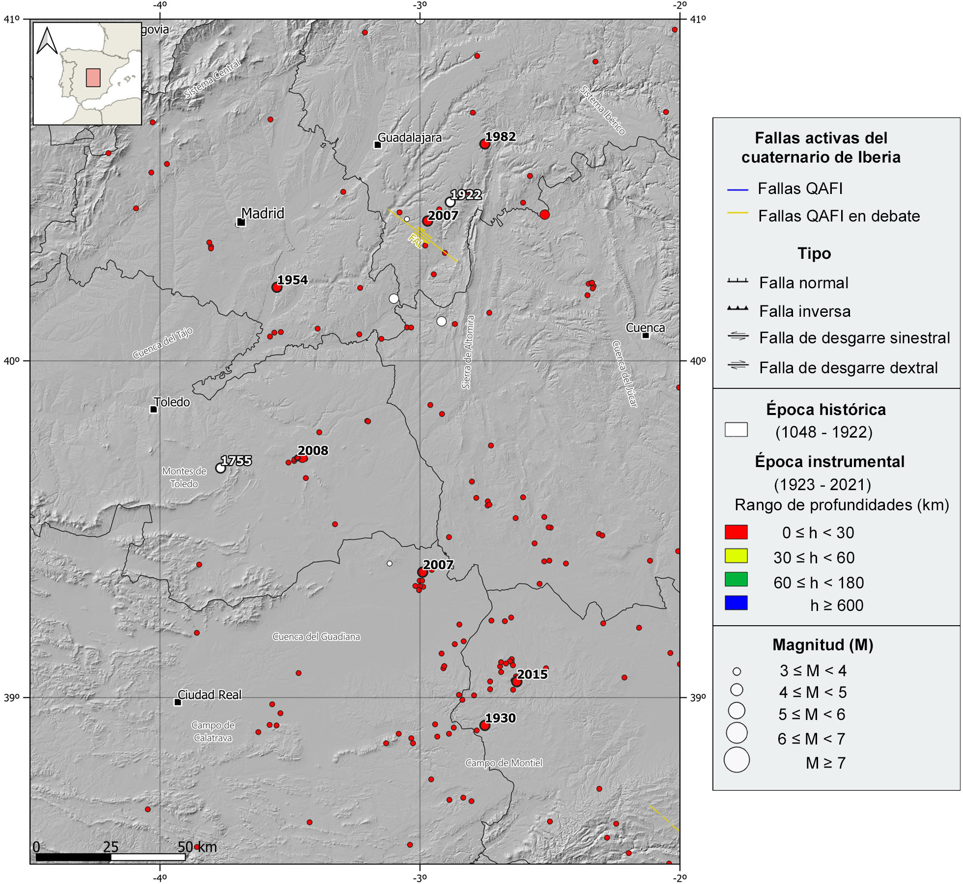
This region is enclosed within the Central Plateau regional context, geographical feature that extends along most of the central territory of the Iberian Peninsula with an average height of 650 m above sea level. Specifically, the study area is limited to the center and southern part of the Southern Subplateau, which is the southern portion of the Central Plateau, and contains the upper and medium parts of the hydrographic basins of the Tajo River to the north, the Guadiana River to the south, and the Jucar River to the east. These basins are bounded by different mountain ranges, to the NW the Central System, to the NE the Iberian System, and to the south the Betic Cordillera. To the west, the Toledo Mountains are also encompassed in this region.
Geologically speaking, this region is characterized by the development of the Tajo River foreland basin during the Cenozoic. The precambrian and paleozoic rocks of the Iberian Massif form the basement of this basin. The sedimentary infill consists mainly of continental and clastic Cenozoic rocks, and its generation and deposition are linked to the Alpine Orogeny, the tectonic process responsible for the uplift or reactivation of the surrounding mountain ranges which are the source of the deposited sediments. This foreland basin is subdivided in two, the Madrid Subbasin to the west, and the Loranca Subbasin to the east. These subbasins are separated by the Altomira Mountains, a southwestern branch of the Iberian System that is oriented N-S along the Guadalajara y Cuenca provinces. This relief is formed by Mesozoic sedimentary rocks, mainly carbonatic, and early Cenozoic series mainly clastic. These two subbasins were always connected by the northern part, and therefore, they were probably clogged simultaneously, although their maximum sediment thickness is different, around 3500 m in the Madrid Subbasin, and around 1400 m in the Loranca Subbasin.
In the southern portion of this region, where the upper and medium parts of the Guadiana River hydrographic basin are located, there are two remarkable geological features. To the west, the “Campo de Calatrava”, this area shows a great variability of rock outcrops, from the paleozoic shales and quarzites of the Iberian Massif, to the tertiary clastic sediments infilling the basin, but the most characteristic rock outcrops are formed by igneous rocks related to recent volcanic episodes, activity registered from the Cenozoic to the Quaternary with an origin linked to the Alpine Orogeny. To the east, the “Campo de Montiel”, this environment is developed on mesozoic and mainly carbonatic materials (Triassic and Jurassic) that were formed at the northern foothills of the Betic Cordillera, but they are almost not deformed, it means, there wasn´t impact of the Alpine Orogeny. The Ruidera Lakes are in this zone and are one of the most important travertine complexes in Europe.
| © Instituto Geográfico Nacional - C/ General Ibáñez de Ibero, 3. 28003 Madrid - España.
sismologia@transportes.gob.es |


