
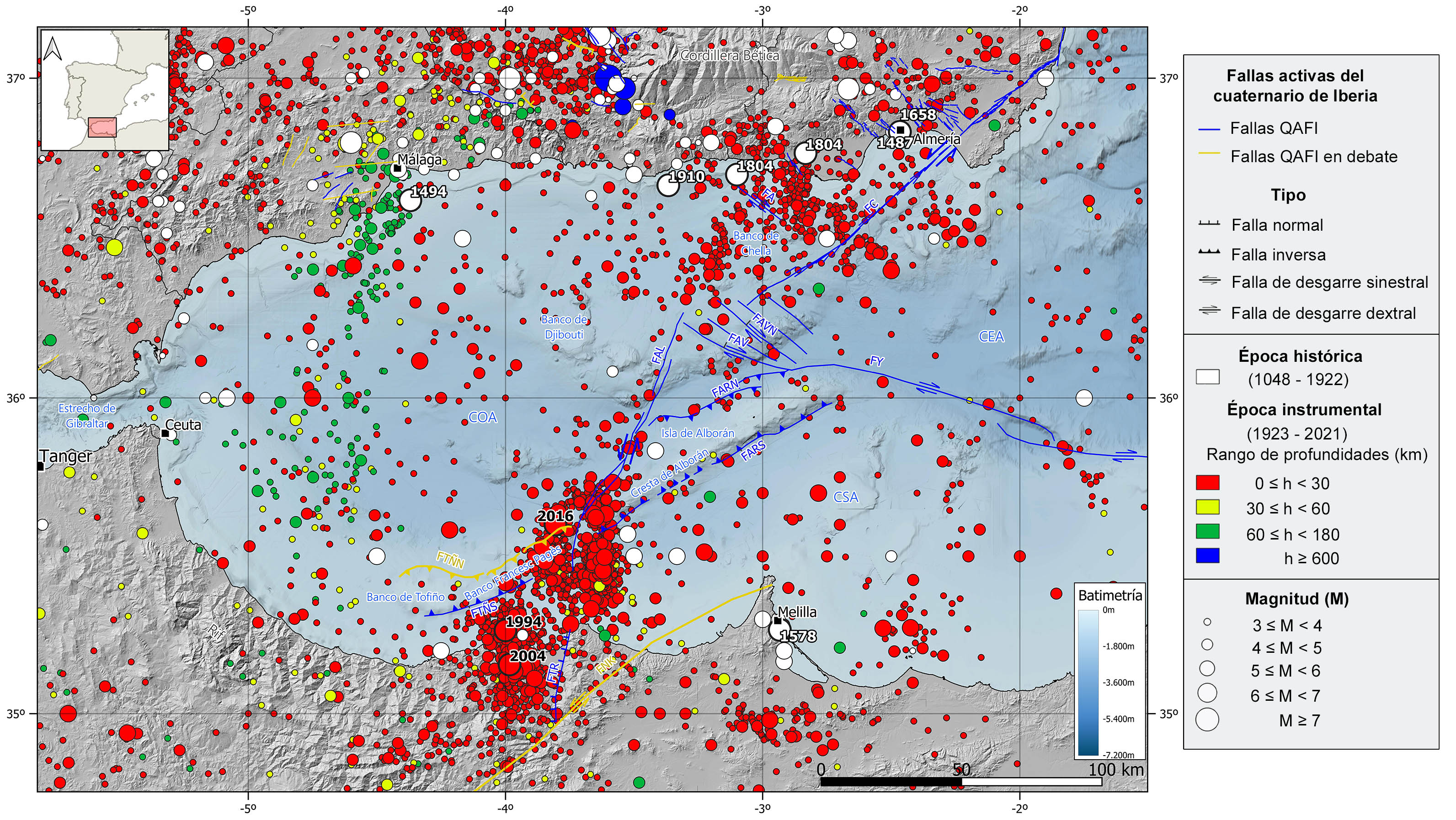
The Alboran basin is located in the western edge of the Mediterranean Sea. It is the inner zone of the Gibraltar Arc as it is surrounded by the arc-shaped mountain range formed by the Betic System in the Iberian Peninsula, the Strait of Gibraltar and the Rif mountains in Morocco.
The Alboran Sea bathes the southeastern coast of the Peninsula over this basin, the northeastern coast of Morocco and the northwestern coast of Algeria. It is 350 km long in the E-W direction and the max-width is 180 km in the N-S direction. The average water depth is 1000 m, but it is over 2000 m in the deepest zones. There are many seafloor reliefs, in the southern area, the Alboran Ridge Crest and the Francesc Pagès and Tofiño Banks, NE-SW submarine mountain ridges, and in the northern area, the Djibouti and Chella Banks, are the most relevant reliefs. Moreover, some islands emerge in the region, they are mostly volcanic islands, and the most important one is the Alboran island, the single outcrop above sea level in the Alboran Ridge Crest.
Geologically speaking, it is a complex region with different crustal domains. In a simplified manner, the Alboran Sea seafloor consist of thinned continental crust (12-20 km) formed mainly by paleozoic and triassic (early Mesozoic) strongly metamorphosed rocks. On top of this basement there is a tertiary (Neogene) and quaternary discordant sedimentary cover, and therefore, contemporary to the basin formation and the uplift of the mountain ranges of the Gibraltar Arc. The sediment cover thickness strongly varies from some areas to others, reaching maximum values of 8 km in the westernmost part.
| © Instituto Geográfico Nacional - C/ General Ibáñez de Ibero, 3. 28003 Madrid - España.
sismologia@transportes.gob.es |


