
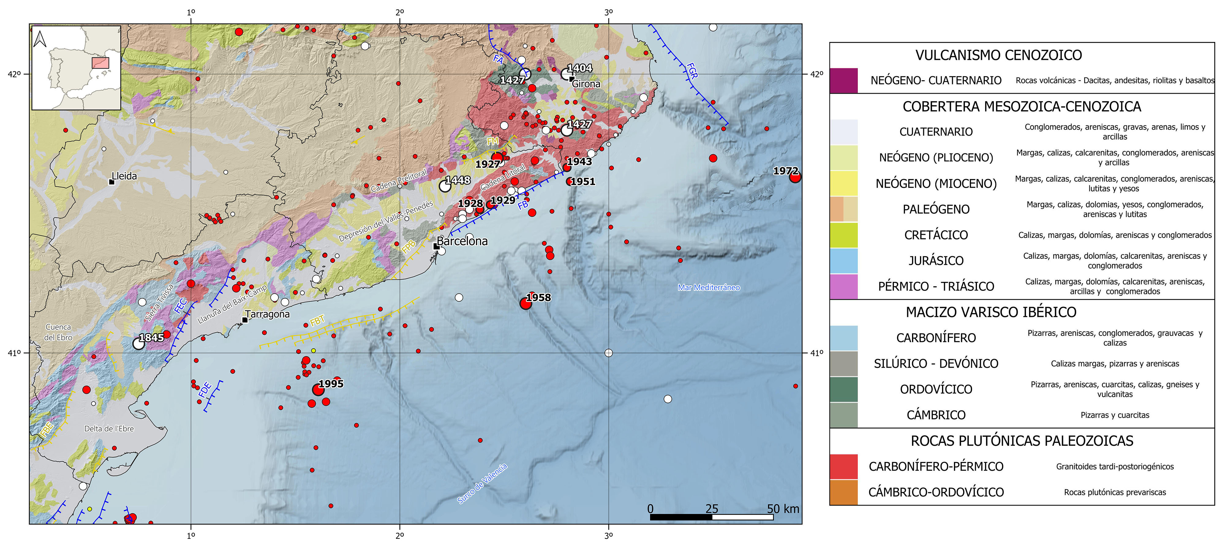
The seismicity of this region is characterized by low to moderate magnitude earthquakes, mostly at shallow depths (< 20 km) and mainly located in the northern and central end of the mountain range, as well as in the Mediterranean Sea, offshore the coasts of Tarragona and Barcelona.
In the historical catalog, the seismicity is mainly located in the northern sector. It is worth mentioning the 1427 Amer (Girona) seismic series which is attributed to the Amer fault. From this series, at least five earthquakes had intensity greater than VII, one of them reaching intensity VIII, and estimated magnitudes between 5.4 and 5.9. There can be also pointed out other several events in this region with slightly lower intensities, between VI and VII, and estimated magnitudes between 5.4 and 5.7, the 1404 Girona, 1427 Caldes de Malavella (Girona), 1448 Cardedeu (Barcelona), and 1845 Tivissa (Tarragona) earthquakes.
In instrumental period, however, there are no earthquakes of magnitude larger than 5.0 in this area, except for the 1927 earthquake in Sant Celoni (Barcelona) with an estimated magnitude of 5.4 and felt with a maximum intensity of VII. Among the largest earthquakes in the instrumental catalog, we can highlight the 1928 and 1929 M4.9 events occurred in Cabrils and Mataró (Barcelona) and felt with maximum intensities VI and V, respectively. More recently, it can be mentioned the 1943 (M4.5) Blanes (Girona) and 1951 (M4.6) Calella (Barcelona) earthquakes, both felt with intensity V. With epicenter in the Mediterranean Sea, we can point out the 1958, 1972, and 1995 earthquakes of magnitude around 5 and felt with maximum intensities between IV and V.
| © Instituto Geográfico Nacional - C/ General Ibáñez de Ibero, 3. 28003 Madrid - España.
sismologia@transportes.gob.es |


