
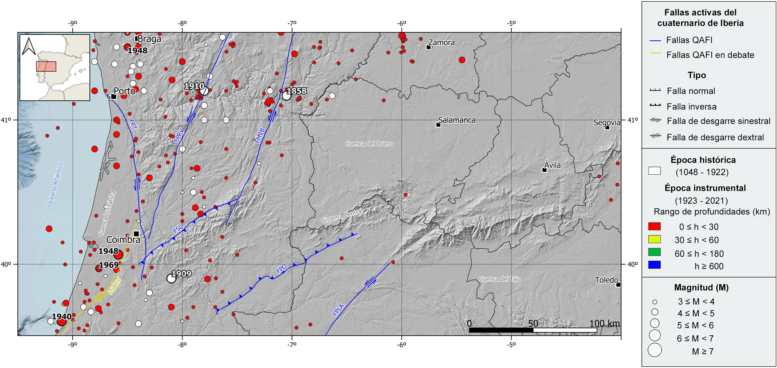
Seismicity in the center-west area of the Iberian Peninsula is relatively scarce and is mainly concentrated in the western part of this region, distributed along Portugal, where a few clusters and alignments of epicenters can be observed, some of which have been related with long active mapped structures. Most earthquakes are of shallow depth (h<30 km) and low magnitude, although some moderate magnitude events, not exceeding M6 and a maximum intensity (EMS-98) of VII, have also occurred in this area. Available focal mechanisms are very scarce with a predominance of normal and strike-slip type, in concordance with the current tectonics.
In the northern sector of Portugal, in the historical catalog, we can highlight the 1858 Moncorvo earthquake, felt with maximum intensity VI-VII and estimated magnitude 5.1, located near the Manteigas-Vilariça-Bragança fault, and the 1910 Caldas de Moledo earthquake, with maximum intensity VII and estimated magnitude 5.4, located near the Penacova-Regua-Verín fault. In the instrumental period, it is noteworthy the 1948 Braga earthquake of magnitude 4.9 and maximum intensity V.
In the southern sector of this region, it is worth mentioning the 1909 Pedrograo historical earthquake, felt with maximum intensity VII and estimated magnitude 5.4. In the instrumental record, three earthquakes occurred in the Lusitanian basin, along the Nazaré-Caldas da Rainha-Vimeiro debated fault, can be highlighted, the largest one in 1940 in Nazaré of magnitude 5.4 and maximum intensity VII. The other two events, the 1948 Condeixa and 1969 NW Pombal earthquakes, had magnitudes near 5 and intensities V and VI, respectively.
| © Instituto Geográfico Nacional - C/ General Ibáñez de Ibero, 3. 28003 Madrid - España.
sismologia@transportes.gob.es |


