Castellano | Catalá | Euskera | Galego | Valencià | English
Menu

150th ANNIVERSARY
NATIONAL GEOGRAPHIC INSTITUTE

Your world, our reference

150 years

National Geographic Institute

In 2020, the National Geographic Institute (IGN) celebrates a century and a half of existence. Since its creation on 12 September 1870, it has been 150 years of intense work, full of projects, ideas, tasks and results, always at the service of society, measuring and representing the world that surrounds us. This is a mission in constant evolution that began by determining the shape and dimensions of the Earth, the production of maps and land registries, and management of the official weights and measurements system to end up including, in the twenty-first century, the most advanced technologies in the fields of Astronomy, Geodesy, Geophysics, Cartography and Geomatics.

551
People

150 years

Programme of Events

The National Geographic Institute presents the following programme of events


Opening of the Exhibition "150 years of the National Geographic Institute"

Opening of the exhibition
Inaugurated by His Majesty King Felipe VI on September 14, 2020. More info.

Lecture series 150th anniversary

Lecture series
Started February 19, 2020. More info.

Presentation of Commemorative Stamps. "Cartography in Stamps" Exhibition

Presentation of Commemorative Stamps

november 2020

Ministry of Transport, Mobility and Urban Agenda

Book Presentation, "The National Geographic Institute: 150 years”

December 2020

Royal Observatory of Madrid

IGN exhibition in Metro de Madrid

January 2021

Guzmán el Bueno metro station

Tribute Saint Isidore of Seville 2020 (Saint of the IGN)

April 26, 2021

National Geographic Institute headquarters

Closure of the Programme of Events

September 14, 2021

National Geographic Institute headquarters

150 years

Exhibitions and Congresses

Come visit our facilities to learn about the history of our cartographic and instrumentation collections and attend the many congresses and events we will be organising.


project 1

150 years of the National Geographic Institute

VenueNational Geographic Institute headquarters
DateFrom September 14, 2020
ContentsThe most emblematic documents, maps, instruments and objects
ConsultMore info

In 2020, the National Geographic Institute marks 150 years since its founding. To celebrate the anniversary, this exhibition has been organised to revisit the most outstanding landmarks during this century and a half of trajectory. The IGN Exhibition Hall presents the most emblematic documents, maps, instruments and objects used by the IGN to perform its duties in providing scientific and geographic information about the Earth. The journey through the exhibition takes us back in time to learn about how the Institute worked in the past and how it has evolved up to the present.

project 2

The maps and the first circumnavigation of the World. Magellan and Elcano’s voyage

VenueNational Geographic Institute headquarters
DateApril 2019 - december 2020
ContentsThis exhibition shows interesting aspects of the trip in a cartographic route: its background, preparations, development and consequences.
ConsultMore info

The first circumnavigation of the world started in 1519 and finished three years later, in 1522. It is considered the greatest feat in the history of explorations, and could be compared with the other modern landmarks such as the first Moon landing. This Spanish enterprise was promoted and led by the Portuguese Ferdinand Magellan and commanded back to Spain by the Spaniard Juan Sebastián Elcano. The exhibition shows the most interesting aspects of the trip in a cartographic route. Starting from the geographical concepts of the ancients, we will go through the unexpected discovery of the American continent, the cartographic espionage between the two Iberian powers, the spice trade or the first maps of the Strait of Magellan and the Moluccan Islands, everything immersed in the atmosphere of the 16th century.

project 2

Royal Observatory of Madrid

VenueC/ Alfonso XII, 3, 28014, Madrid
DatesDeferred until further notice
ContentA valuable collection of ancient instrumentation
ConsultMore info

In a visit to the Royal Observatory of Madrid you can learn about the evolution of Astronomy and other related sciences such as Geodesy, Cartography, and Geophysics, in addition to exploring a valuable collection of scientific and astronomical instrumentation.

project 6

Geomagnetic Observatory

of San Pablo de los Montes

VenueCarretera de las Navillas, km. 3,5 (San Pablo de los Montes. Toledo)
DateApril 15, 2021 by appointment (925 250 642) Places limited to 20 people
ContentObservatory dedicated to research in the fields of Seismology and Geomagnetism.

The Geophysical Observatory of San Pablo de los Montes – Toledo (SPT) is a center dedicated to the monitoring of seismic movements and the Earth's magnetic field, using extremely precise instrumentation installed in pavilions expressly prepared for it. This Observatory is included within the Global Seismic Network (GSN) and the World Network of Geomagnetic Observatories (Intermagnet).

project 3

Geophysical Observatory of Toledo

Venue Avda. Adolfo Suárez, km 4 (45005 Toledo)
DatesDeferred until further notice
ContentHistorical Geophysical Instrumentation
ConsultMore info

In the Geophysical Observatory of Toledo you can visit the exhibition "Historical Geophysical Instrumentation”. This exhibit features an important collection of geophysical instruments, mainly related to seismology and geomagnetism, which have been used throughout history in the IGN’s different Geophysical Observatories.

project 4

Astroyebes Astronomy Classroom

VenueYebes Observatory (Guadalajara). Cerro de la Palera, s/n.
DatesDeferred until further notice
ContentInformational space for astronomical research and knowledge
ConsultMore info

The Yebes Astronomy Classroom is an informational resource which, in an entertaining and understandable way, brings students and the general public closer to the content included in non-university educational programs on astronomy: seasons of the year, lunar phases, time zones, the solar system, the ecliptic, the zodiac, famous constellations, celestial movements, etc. It also includes an introduction to radio astronomy.

project 5

From Iberia to Spain through Maps

VenueMurcia and Águilas
DatesDeferred until further notice
ContentA journey through the diverse cartographic representations of Spain throughout its history
ConsultMore info

This exhibition is a journey through the different cartographic representations of Spain throughout its history, starting with the first references to the Peninsula: the Iberia of the Greeks, the Roman-Hispanic period, the scientific cartography of Claudius Ptolemy, beautified people and nautical charts in the Middle Ages, the golden age of cartography in the sixteenth and seventeenth centuries and mapping from the eighteenth century. The exhibition closes with the map of Spain’s provincial division in 1833, established with the then Minister for Development Javier de Burgos a few decades before the foundation of the National Geographic Institute in 1870.

project 6

Ecumene: The evolution of the image of the World

VenueAlbacete / Toledo
DateDeferred until further notice
ContentThis exhibition aims to show a chronological succession of cartographic documents that illustrate the changes that the image of the Ecumene has had over more than 2,500 years: the world inhabited and known by the ancients.

Since ancient times, one of the main concerns of the human being has been to know what the World in which he lives is like, trying to answer questions such as, what is the shape of the Earth? What are its dimensions? Or what relationship does it have with the heavenly bodies? Starting from the first geographical references of ancient Greece, which considered a flat World, we will go through the spherical Earth proposed by prominent names such as Aristotle and Eratosthenes, following the maps of "T in O" and the nautical charts of the Middle Ages, the rediscovery of the Geography of Ptolemy in the Renaissance, until reaching the great oceanic explorations that finished delineating the World as we know it today.

project 7

ATLASES IN TIME International Meeting on Atlases and Toponymy, Commissions from the International Cartographic Association (ICA)

VenueNational Geographic Institute headquarters
DateDate to be confirmed
ContentWorkshop on atlases and toponymy
ConsultMore info

The International Cartographic Association (ICA) Commission on Atlases, the ICA-IGU Commission On Toponymy, the National Geographic Institute and the Spanish Society of Cartography, Photogrammetry and Remote Sensing (SECFT) will jointly organize a workshop on atlases and toponymy in Madrid.

project 8

10th Portuguese Hispanic Assembly of Geodesy and Geophysics

Venue Geophysical Observatory of Toledo
DateDeferred until further notice
ContentA meeting of the entire Spanish and Portuguese scientific communities, extended as well to the European and Maghreb scientific communities.
ConsultMore info

The Spanish Commission of Geodesy and Geophysics, the National Geographic Institute and the Instituto Português do Mar e da Atmosfera invites the entire Spanish and Portuguese scientific communities, extended as well to the European and Maghreb scientific communities, to participate in this meeting on Geodesy and Geophysics.

project 9

Working Group of Spanish and Portuguese Public Map Libraries

VenueNational Geographic Institute headquarters
DateDeferred until further notice
ContentCartographic Documentation
ConsultMore info

The Working Group of Spanish and Portuguese Public Map Libraries (Ibercarto), made up of Spanish and Portuguese professionals in cartographic documentation, is holding its IX Congress in Madrid at the headquarters of the National Geographic Institute.

project 10

Pan American Institute of Geography and History 50th Directing Council Meeting

VenueVirtual mode
DateOctober 7
ContentDirecting Council Statutory Meeting
ConsultMore info

The Pan American Institute of Geography and History was founded on 7 February 1928 during the Sixth International Conference held in Havana, Cuba. At the request of the delegation from the Mexican government, the headquarters was established in Mexico City. Since its founding, the Pan American Institute of Geography and History has supported and emphatically contributed to the advancement of the sciences that form part of its scope.

project 11

XII International Congress of Geomatics and Earth Sciences, TOPCART2020

VenueBox Cartuja, Albert Einstein street s/n, Seville, Spain
DatePostponed to 2021
ContentXII International Congress of Geomatics and Earth Sciences, TOPCART2020
ConsultMore info

The XII International Congress on Geomatics and Earth Sciences 2020, organized every four years by the Illustrious Official College of Geomatic and Topographic Engineering, aims to publicize scientific and technical advances in the field of Geomatics and other related sciences.

project 14

JIIDE 2020. XI Iberian Conference on Spatial Data Infrastructures

VenueVirtual conferences
DateOctober 26-30, 2020
ContentXI Iberian Conference on Spatial Data Infrastructures
ConsultMore info

JIIDE 2020 motto: "Contributions for the development of a low carbon economy". The Conference on Spatial Data Infrastructures (JIIDE) are the result of the collaboration of the Direção-Geral do Território de Portugal, the National Geographic Institute of Spain, through the National Center for Geographic Information and the Government of Andorra. The XI edition of this conference, which has been decided to be held this year 2020 virtually. it will focus on issues related to a low carbon economy.

  • project 1

    150 years of the IGN


    Exhibition

  • project 2

    The maps and the first circumnavigation of the World

    Exhibition

  • project 2

    Royal Observatory of Madrid


    Guided visit

  • project 3

    Geophysical Observatory of Toledo


    Exhibition

  • project 4

    Astroyebes Astronomy Classroom


    Guided visit

  • project 6

    Observatorio Geofísico de San Pablo de los Montes

    Guided visit

  • project 5

    From Iberia to Spain through Maps


    Exhibition

  • project 6

    Ecumene: The evolution of the image of the World

    Exhibition

  • project 7

    Commissions from the International Cartographic Association.

    Congress

  • project 8

    10th Portuguese Hispanic Assembly of Geodesy and Geophysics

    Congress

  • project 9

    Working Group of Spanish-Portuguese Public Map Libraries

    Congress

  • project 10

    Pan American Institute of Geography and History

    50th Directing Council Meeting

  • project 13

    XII International Congress of Geomatics and Earth Sciences

    Congress

  • project 14

    XI Iberian Conference on Spatial Data Infrastructures

    Congress


150 years

Conferences

Presentations with informative and scientific-technical content related to areas of expertise in Astronomy, Geodesy, Geophysics, Geomatics and Cartography

Time: 19:00

Approximate Duration: 50 minutes

Free admission until full capacity


Scheduled conferences


Conferences scheduled have been postponed; the cycle of conferences will resume in October. New dates will be announced shortly.

Royal Observatory of Madrid


A Revolution in Astronomy


Miguel Santander

The Renaissance was an authentic revolution in Astronomy. The Copernican model, the invention and use of the telescope by Galileo or Kepler's obsession with the movement of the planets are examples of a thrilling period.

National Geographic Institute

The Silent Threat of Earthquakes in our Daily Life

Emilio Carreño

The safety of our homes, natural seismic activity, seismic activity caused by dams and even nuclear tests are examples of what is continually and meticulously monitored by our seismic networks.

Royal Observatory of Madrid

Geniuses and Expeditions: Astronomy in the Enlightenment

Javier Alcolea

At the end of the Modern Age, the rise of rationalism accelerated Astronomy’s progress, starting with Newton's law of universal gravitation and ending with the first measurements then known of the size of the Universe.

National Geographic Institute


The Quantum Kilo and New Units from the SI

José Manuel Bernabé

A brief overview of the history of Metrology, its phase in the IGN and an explanation of how units are now defined in the International System (SI).

20
May
Royal Observatory of Madrid

The Solar System is Populated and Nebulae are Studied


Asunción Fuente

The technological, scientific and social revolution that shook Europe in the nineteenth century was reflected in Astronomy. Women, newly incorporated into science, played a stellar role in this transition.

28
May
National Geographic Institute

The Map of the Future is Already Here


Celia Sevilla and Marta Juanatey

Hyper-realistic 3D scenes of National Parks, your Map on Demand, Interactive Atlas, SIGNA, mobile applications and Standard Web Services: how technology is changing our relationship to maps.

17
Jun
Royal Observatory of Madrid

The Universe Grows and Evolves: the Galaxies and Astrophysics

Santiago García Burillo

In the twentieth century, the transformation of Astronomy into the modern science of Astrophysics was completed. The evolution of stars and the structure and dimensions of both our galaxy and the universe on a large scale is studied.

25
Jun
National Geographic Institute

Extraordinary Black Holes


Rafael Bachiller and Pablo de Vicente

A history of fascinating Black Holes, a summary of their properties and an explanation of how it has been possible to photograph one.

16
Sept


Royal Observatory of Madrid

Astrophysics in our Time


Valetín Bujarrabal

Until the twentieth century, observation of the stars was practically limited to their visible light, whether to the naked eye or with traditional telescopes. Technological progress has made it possible for us to observe the sky with other eyes.

24
Sept
National Geographic Institute

Evolution of the Image of the World


Marcos Pavo

The image that man has of the world he inhabits is inextricably connected to its cartographic representation. The history of cartography is a faithful reflection of the progressive discovery of a world that was incomprehensible and unknown until not so long ago.

21
Oct
Royal Observatory of Madrid

Space Astronomy


Pablo de Vicente

The space race gave rise to a new phase in the history of Astronomy. Human beings reach the Moon, robotic probes explore the Solar System and space telescopes revolutionize our knowledge.

29
Oct
National Geographic Institute

From Jules Verne to Volcanic Monitoring Networks


Carmen López

Review of the key volcanic phenomena. From Vesuvius and Pliny the Younger by way of Santorini, Krakatoa and up to volcanoes in eruption today. The eruption of El Hierro, the latest advances in volcanic monitoring and volcanic surveillance at the IGN.

18
Nov
Royal Observatory of Madrid

Astronomy of the Future


Rafael Bachiller

Exoplanets, dark matter and dark energy, black holes and protostars are some of the topics at the forefront of science. For their study, the most ambitious observatories in history are being built, while detection of gravitational waves and diverse particles arriving from space are being examined.

26
Nov
National Geographic Institute

The History of Spain in its Names


Angélica Castaño

The different civilisations that have inhabited Spain over time have left their mark on geographical names that have lasted to our time, being faithful witnesses to Spain’s history.

3
Dec
National Geographic Institute

Artificial Intelligence in Society and Cartography


Fco. Javier González Matesanz

Human beings have always tried to mathematically conceptualise the technical problems in cartography, but… were we wrong? Perhaps we should simply approach them like we did when we learned as children.


Conferences given


19
Feb

Royal Observatory of Madrid

What a Small World! Pre-telescopic Astronomy

Pere Planesas.

In the centuries prior to the invention of the telescope, study of the heavens advanced thanks to ancient civilizations that flourished in Asia, Europe and North Africa between prehistory and the Middle Ages.

27
Feb
National Geographic Institute

The Evolution of Positioning. A Story of Achievement

Marcelino Valdés.

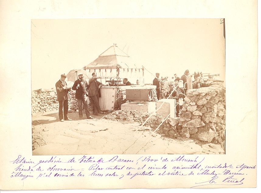
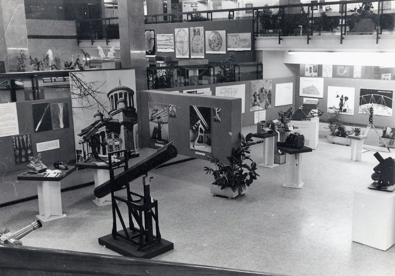
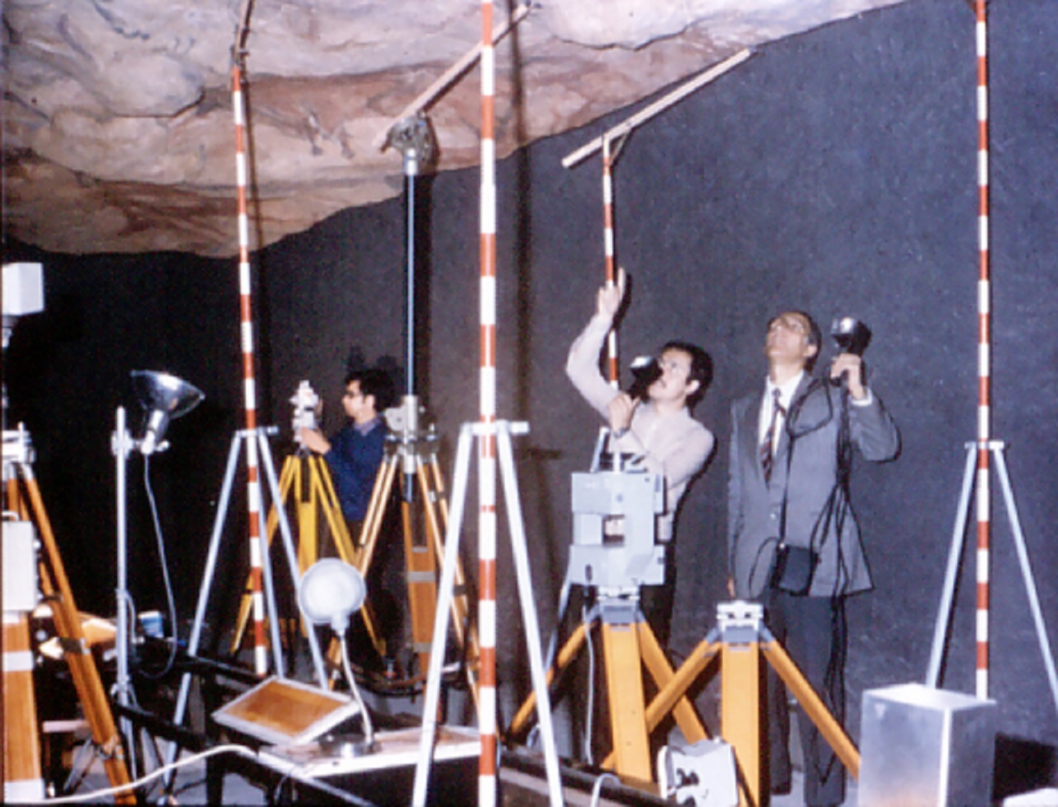
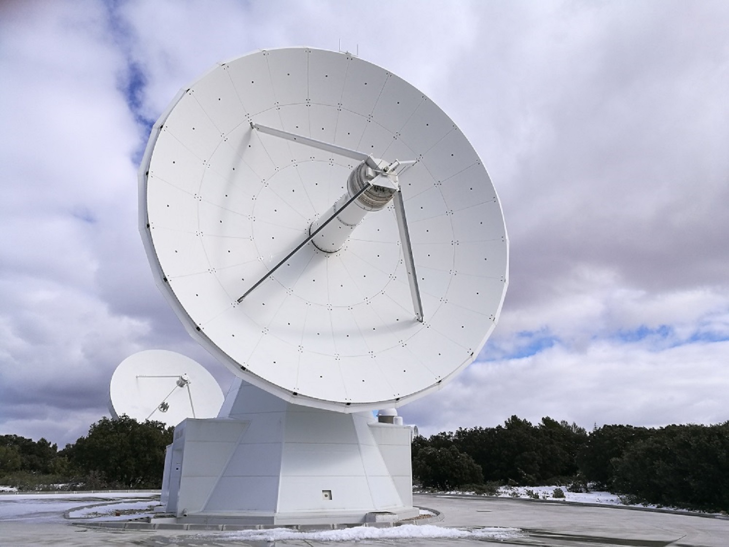
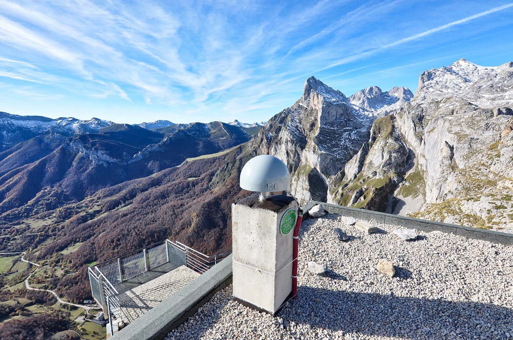
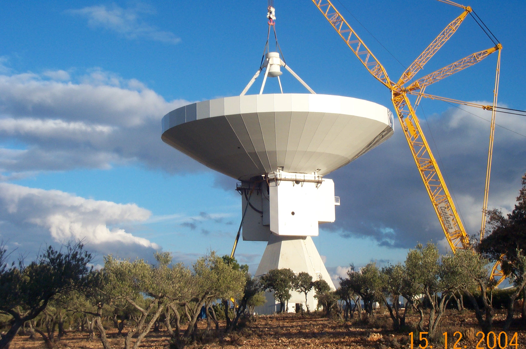
An historical review of the way in which man has oriented himself on the Earth's surface. During this evolution, technical accuracy has been improving to the point of millimetric precision. How knowledge on the Earth’s shape and the emergence of spatial geodesic techniques have been essential in this achievement will be analysed.

Repaso histórico de la forma en que el hombre se ha ubicado sobre la superficie terrestre. Durante esta evolución la precisión de las técnicas ha ido mejorando hasta precisiones del orden del milímetro. Se analizará como el conocimiento de la forma de la Tierra y la irrupción de las técnicas geodésicas espaciales ha sido esencial en este logro.

Instituto Geográfico Nacional
C/ General Ibáñez de Íbero, 3
28003 Madrid

Metro station: Guzmán el Bueno (Lines 6 and 7)

Bus: Lines C1, C2, F, 2, 44, 45

See in Viewer

Real Observatorio de Madrid
C/ Alfonso XII, 3
28014 Madrid

Metro station: Atoche Renfe and Estación del Arte (Line 1) and cercanías Renfe

Bus:Lines C1, C2, E1, 10, 14, 19, 26, 27, 32, 34, 37, 45

See in Viewer

150 years

Photographs and images

Selection of photographs and images of the most relevant work, projects and events from throughout our history

Open photo gallery

Alfonso XIII lays the first stone and inaugurates work on the IGN’s building. Year: 1922

The Beginning of the Institution

Although the history of the IGN began in 1870, when a scientific entity called the Geographic Institute was created in the Ministry of Development, the truth is that in the eighteenth century the momentum of the Enlightenment was already looking to respond to growing geographical needs. With the decree of 12 September 1870, signed by Mr. Francisco Serrano, the Geographic Institute was created and Mr. Carlos Ibáñez e Ibáñez de Íbero, an engineering colonel, was named General Director. The creation of the Institute, which standardised Spain with other European countries, represents the triumph of an idea of cartography built around a technical and civil conception.

Observation tent in Vértice Tetica, Bacares (Almeria).Year:1924

Vértice Tetica, Bacares (Almería).

Work on the geodesic connection with Morocco. Vértice Tetica, Bacares (Almería). Year: 1924 Work on the connection of Europe with Africa, Spain with Algeria.

Historic exposition

The institution evolves

Photo of the exhibition

Photogrammetry. Data collection for the creation of the "Neocueva" of Altamira

“Neocueva” of Altamira

“Neocueva” of Altamira, Santillana del Mar (Cantabria). Year: 1978 With a study done by the IGN, an exact replica of the cave was made, having great importance for tourism and cultural purposes.

Main entrance of the School of Topography. Course 68-69

School of Topography. Professor Julián de Castro

Created by Decree on 24 September 1954 and reporting to the Ministry of National Education, the School of Topography has as its mission to train topographers, preparing graduates to freely exercise the profession as well as for entry in the above-mentioned corps and, in general, to perform this activity in other public entities and corporations.

Yebes Observatory Telescope

Yebes Observatory (Guadalajara)

Since 2013, the Yebes Observatory has been a Spanish Singular Scientific and Technical Infrastructure (ICTS). Its integration into the existing map of ICTS was confirmed in November 2018, and it is considered a unique localisation infrastructure that forms part of the ICTS “Network of Astronomy Infrastructures”.

Santander SIOSE

Spanish Land Use Information System (SIOSE)

The city of Santander in an image from the Spanish Land Use Information System.

Station of the National Geodetic Network of Reference Stations GNSS (Global Navigation Satellite System) in Fuente Dé (Cantabria)

ERGNSS Network

One of the more than 100 permanent GPS/GNSS reference stations from the ERGNSS Network that are found throughout the country, in Fuente Dé (Cantabria).

Construction of the 40m Radio Telescope in Yebes (Guadalajara)

Astronomical Observatory of the National Geographic Institute

This instrument weighs 300 tonnes and allows the composition of comets, formation of the stars, and displacement of tectonic plates to be researched, among other applications, and in combination with other telescopes, using Very-long-baseline interferometry (VLBI), to study some of the most distant celestial bodies as well as remote galaxies that have black holes.

Quality and Innovation Awards in Public Management

“Best Practices” Award to the National Geographic Institute Year 2007

Improvement in internal management processes that ensure the reliability of goods and services produced, efficiency in management of public funds, proper utilisation of new technologies, a work climate and stable, fluid and productive relationship with the rest of the actors in the public cartographic system.

LiDAR Map of the Community of Madrid

PNOA LiDAR

Digital Model of shaded surfaces that have been overlaid with two layers coming from rasterization of edification and vegetation classes from point clouds in .LAS format and a third layer from hydrography.

Map of Natura 2000 network. Mainland Spain and the Balearic Islands. 2016

Spanish National Atlas in the Twenty-first Century

Protected areas are an essential tool in the conservation of ecosystems and survival of the species. This original role, purely conservationist, has grown over recent years with the addition of social and economic features. This map can be accessed in the overview found in "Spain through Maps”. A Geographic Synthesis from the Spanish National Atlas in the Twenty-first Century.

Earthquake and Tsunami Warning Room

National Geographic Institute. Year 2020

The IGN’s Spanish National Atlas is a reference work with data from the State Administration and from academic and scientific organizations. This Atlas uses digital models from the environment on a scale of 1:3,000,000

Official presentation of «Spain on maps. A geographical synthesis »of the National Atlas of Spain

The team of the National Atlas of Spain with the Minister of Transport, Mobility and Urban Agenda

On December 12, 2018, at an event that took place at the Royal Observatory of Madrid, the Minister of Transportation, Mobility and Urban Agency D. José Luis Ábalos Meco presided over the presentation of the publication «Spain on maps. A geographical synthesis »of the Compendiums of the National Atlas of Spain (ANE) series, which he described as outstanding work and a fundamental reference.

Spanish Geographic Society Awards

SGE Communication Award 2018: National Atlas of Spain of the IGN. 2019 year.

His Majesty King Don Felipe VI gives the SGE Communication Award 2018: National Atlas of Spain of the IGN, to Lorenzo García Asensio, general director of the National Geographic Institute and president of the National Center for Geographic Information. The National Atlas of Spain of the National Geographic Institute has been awarded this Prize, which recognizes the work of magazines, editorials, media, TV programs, journalists or projects that have stood out for the dissemination of geography and of knowledge of the planet.


150 years

Documentation

Selection of related documents, videos and published news

Videos

The National Geographic Institute

The Yebes Observatory

The map: beginning and end of the road