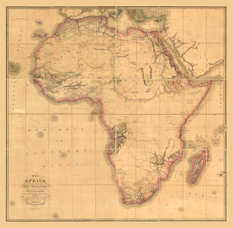
Map of África: compiled from the most authentic acounts of Travels, Ancient and Modern
🗺️ Ámbito geográfico
África
🏷️ Materia
Mapas político-administrativos
⏳ Fecha
1858
✍️ Autor(es)
including those performed under the Patronage of the African Association ; by Mungo Park, Hornemann, Major Houghton, & ; likewise those of Burchell ... [et al.] ; assisted by the Reports of the Missionary Societies.
compiled from the most authentic acounts of Travels, Ancient and Modern
$c - Responsable
including those performed under the Patronage of the African Association ; by Mungo Park, Hornemann, Major Houghton, & ; likewise those of Burchell ... [et al.] ; assisted by the Reports of the Missionary Societies.
Map of África: compiled from the most authentic acounts of Travels, Ancient and Modern [Material cartográfico] including those performed under the Patronage of the African Association ; by Mungo Park, Hornemann, Major Houghton, & ; likewise those of Burchell ... [et al.] ; assisted by the Reports of the Missionary Societies. Escala [ca. 1:5.600.000]. Gráfica de 400 millas inglesas [= 11,5 cm] (O 30°-E 60°/N 35°-S 35°) Published by James Wyld, Charring Cross, London, 1858
1 mapa en 6 hojas: color, montado en tela: 154 x 155 cm en h de 55 x 82 cm o menos, plegada en 28 x 17
Inserta notas históricas referidas a puntos concretos del mapa.
La política de datos determinada por el IGN, establecida en la Orden FOM/2807/2015, establece que el uso de la información de los productos y servicios de datos geográficos definidos en ella, así como sus derivados, conlleva la aceptación implícita por el usuario de las condiciones generales de dicha orden, concretada en la siguiente licencia de uso, compatible con CC-BY 4.0.


