| Lines of equal magnetic declinaton and of equal annual change in Alaska for 1950. | Alaska (Estados Unidos). Declinación magnética. 1950?.
Escala 1:5.000.000 | Coast and Geodetic Survey. Estados Unidos |  |
| Isogonic chart for 1950, United States. including isoporic lines | Estados Unidos. Mapas isogónicos. 1950.
Escala 1:5.000.000 | Coast and Geodetic Survey. Estados Unidos |  |
| Isogonic chart for 1945, United States. including isporic lines | Estados Unidos. Mapas isogónicos. 1946.
Escala 1:5.000.000 | Coast and Geodetic Survey. Estados Unidos |  |
| St. Thomas. Virgin Islands : scale 1: 40000 | Santo Tomás (Islas Vírgenes). Mapas topográficos. 1922.
Escala 1:40.000 | Coast and Geodetic Survey. Estados Unidos |  |
| St. Croix. Virgin Islands | Santa Cruz (Islas Vírgenes). Mapas topográficos. 1923.
Escala 1:40.000 | Coast and Geodetic Survey. Estados Unidos |  |
| St. John. Virgin Islands | San Juan (Islas Vírgenes). Mapas topográficos. 1922.
Escala 1:40.000 | Coast and Geodetic Survey. Estados Unidos |  |
| Atlas of the Philippine Islands. | Filipinas. Atlas. 1900.
Varias escalas. | Pritchett, Henry S. / Coast and Geodetic Survey. Estados Unidos / Algué, José |  |
| North Pacific Ocean. | Pacífico (Océano). Mapas generales. 1921.
Escala 1:20.000.000. | Coast and Geodetic Survey. Estados Unidos |  |
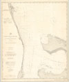
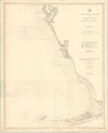
| General Chart of the coast No. XIV Cape Canaveral to Fowey Rocks Florida. | Cabo Cañaveral. Cartas náuticas. 1884.
Escala 1:400.000 | Lindenkohl, Adolph / Coast and Geodetic Survey. Estados Unidos / Hilgard, J.E. / Bache, A. D. / Patterson, Carlile P. |  |
| General Chart of the coast No. XIV, Gulf coast from Key west to Tampa Bay. | Golfo de México. Cartas náuticas. 1893.
Escala 1:400.000 | Ackley, S.M. / Mendenhall, Thomas Corwin / Coast and Geodetic Survey. Estados Unidos / Colonna, B.A. |  |
| Gulf of Mexico and straits od Florida = Golfo de Mexico y estrecho de Florida. | Golfo de México. Cartas náuticas. 1885.
Escala 1:2.100.000 | Boutelle, C. O. / Hilgard, J.E. / Coast and Geodetic Survey. Estados Unidos |  |


