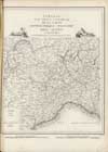
| Alexandrie. | Alpes. Mapas topográficos. 1820.
Escala 1:200.000. | Raymond, J.B.S. / Michel, François-Pierre |  |
| La Spezia. | Alpes. Mapas topográficos. 1820.
Escala 1:200.000. | Raymond, J.B.S. / Michel, François-Pierre |  |
| Valteline. | Alpes. Mapas topográficos. 1820.
Escala 1:200.000. | Raymond, J.B.S. / Michel, François-Pierre |  |
| Nice. | Alpes. Mapas topográficos. 1820.
Escala 1:200.000. | Michel, François-Pierre / Raymond, J.B.S. |  |
| Briançon. | Alpes. Mapas topográficos. 1820.
Escala 1:200.000. | Michel, François-Pierre / Raymond, J.B.S. |  |
| Milan. | Alpes. Mapas topográficos. 1820.
Escala 1:200.000. | Michel, François-Pierre / Raymond, J.B.S. |  |
| Tableau pour servir a l'assemblage de la carte topographique militaire des Alpes. en douze Feuilles | Alpes. Mapas topográficos. 1820.
Escala 1:1.000.000. | Michel, François-Pierre |  |
| Chamberi. | Alpes. Mapas topográficos. 1820.
Escala 1:200.000. | Michel, François-Pierre / Raymond, J.B.S. |  |
| Turin. | Alpes. Mapas topográficos. 1820.
Escala 1:200.000. | Michel, François-Pierre / Raymond, J.B.S. |  |
| Gènes. | Alpes. Mapas topográficos. 1820.
Escala 1:200.000. | Michel, François-Pierre / Raymond, J.B.S. |  |
| Le Simplon. | Alpes. Mapas topográficos. 1820.
Escala 1:200.000 | Michel, François-Pierre / Raymond, J.B.S. |  |
| Genève. | Alpes. Mapas topográficos. 1820.
Escala 1:200.000. | Michel, François-Pierre / Raymond, J.B.S. |  |
| Carte topographique militaire des Alpes. comprenant le Piamont, la Savoye, le Comté de Nice, le Vallais, le Duché de Genes, le Milanais et partie des États limitrophes: dressée a l'Echelle d'un Metre pour 200000 Métres | Alpes. Mapas topográficos. 1820.
Escala 1:200.000. | Michel, François-Pierre / Raymond, J.B.S. |  |


