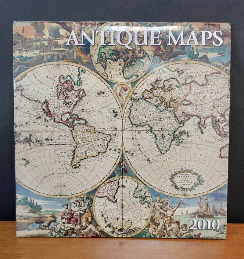
Cada una de las hojas del calendario contiene la reproducción de un mapa diferente. 1) Enero: World map showing Magellan's route of circumnavigation, c.1544 (Geography and Map Division / Library of Congress). 2) Febrero: Maui, Hawaiian Islands, 1885 (Geography and Map Division / Library of Congress). 3) Marzo: Carte de la Louisiane, copied 1896-1901 from 1684 original (Geography and Map Division / Library of Congress). 4) Abril: Universalior Cogniti Orbis Tabula, 1507 (Geography and Map Division / Library of Congress). 5) Mayo: Nova Totius Americae, 1660 (Geography and Map Division / Library of Congress). 6) Junio: Geological Map of the United States, 1874 (Geography and Map Division / Library of Congress). 7) Julio: Hibernia Regnum Vulgo Ireland, 1635 (Geography and Map Division / Library of Congress). 8) Agosto: Nova Totius Terrarum Orbis Tabula, c.1680 (copyright Bildarchiv Preussischer Kulturbesitz / Art Resource, NY). 9) Septiembre: Europa, 1635 (Geography and Map Division / Library of Congress). 10) Octubre: Africae Tabula Nova, 1570 (Geography and Map Division / Library of Congress). 11) Noviembre: Nova et Accuratissima Totius Terrarum Orbis Tabula, c.1664 (Geography and Map Division / Library of Congress). 12) Diciembre: America, c.1619 (copyright Map House / Digital Vision Ltd).
Antique Maps: 2010Silver Lining. Varias escalas. Silver Lining, New York, 2009
1 calendario: color: 17,8 x 17,8 cm cada hoja
Algunos mapas no se corresponden con sus reseñas.
Cada una de las hojas del calendario contiene la reproducción de un mapa diferente. 1) Enero: World map showing Magellan's route of circumnavigation, c.1544 (Geography and Map Division / Library of Congress). 2) Febrero: Maui, Hawaiian Islands, 1885 (Geography and Map Division / Library of Congress). 3) Marzo: Carte de la Louisiane, copied 1896-1901 from 1684 original (Geography and Map Division / Library of Congress). 4) Abril: Universalior Cogniti Orbis Tabula, 1507 (Geography and Map Division / Library of Congress). 5) Mayo: Nova Totius Americae, 1660 (Geography and Map Division / Library of Congress). 6) Junio: Geological Map of the United States, 1874 (Geography and Map Division / Library of Congress). 7) Julio: Hibernia Regnum Vulgo Ireland, 1635 (Geography and Map Division / Library of Congress). 8) Agosto: Nova Totius Terrarum Orbis Tabula, c.1680 (copyright Bildarchiv Preussischer Kulturbesitz / Art Resource, NY). 9) Septiembre: Europa, 1635 (Geography and Map Division / Library of Congress). 10) Octubre: Africae Tabula Nova, 1570 (Geography and Map Division / Library of Congress). 11) Noviembre: Nova et Accuratissima Totius Terrarum Orbis Tabula, c.1664 (Geography and Map Division / Library of Congress). 12) Diciembre: America, c.1619 (copyright Map House / Digital Vision Ltd).
La política de datos determinada por el IGN, establecida en la Orden FOM/2807/2015, establece que el uso de la información de los productos y servicios de datos geográficos definidos en ella, así como sus derivados, conlleva la aceptación implícita por el usuario de las condiciones generales de dicha orden, concretada en la siguiente licencia de uso, compatible con CC-BY 4.0.


